Text and Photos by Alejandra Duarte, Policy Associate, Women4Biodiversity
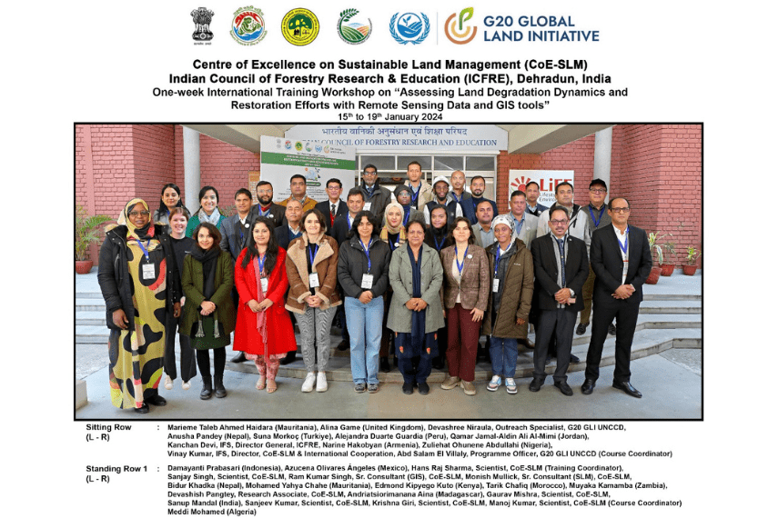
The international training on Assessing Land Degradation Dynamics and Restoration Efforts with Remote Sensing (RS) Data and Geographic Information System (GIS) Tools was organized by the Centre of Excellence on Sustainable Land Management (CoE-SLM), the Indian Council of Forestry Research & Education (ICFRE), Dehradun, Ministry, in Dehradun, India, from 15th to 19th January 2024, its aimed to develop an understanding of land degradation indices and criteria, assessments, early warning systems for land degradation, and other related applications, elaborating on the use of remote sensing data to perform land cover classification.
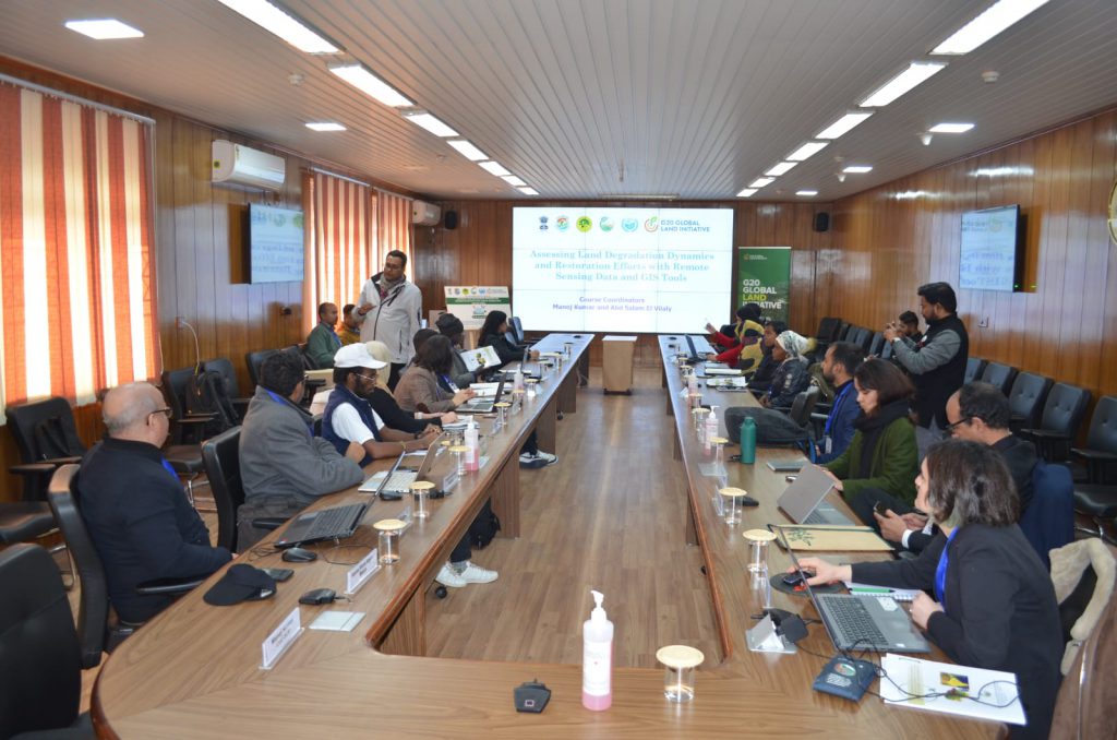
During the course, we explored theoretical foundations and practical applications of RS & GIS tools in the context of land degradation and restoration by national and international experts. Hands-on sessions provided the opportunity to engage directly with cutting-edge tools, such as the Land Degradation Monitoring Toolkit (Trends.Earth) and QGIS software. Course topics were delivered by experts from the following institutions: G20-GLI UNCCD, Centre of Excellence in Sustainable Land Management (CoE SLM); Hexagon, New Delhi; ISRO- Space Application Center, ISRO- National Remote Sensing Centre.
Over the five days of training, we delved into various research and experiences conducted by these institutions, focusing on soil degradation, fire monitoring, and the effects of degradation on biodiversity and vegetation dynamics of affected ecosystems, alongside the monitoring and tracking systems implemented and the use of remote sensing and GIS Tools. The training provided a platform for participants to discuss the challenges and opportunities presented by remote sensing and GIS tools in addressing these issues, underscoring the importance of interdisciplinary collaboration and innovative approaches. We also explored the complicated process of digitization, focusing on the digitization of important features and the entry of both spatial (raster and vector) and non-spatial data within a GIS environment. In addition to the theoretical aspect, we spent several hours creating maps in QGIS and applying the techniques discussed in practical exercises.
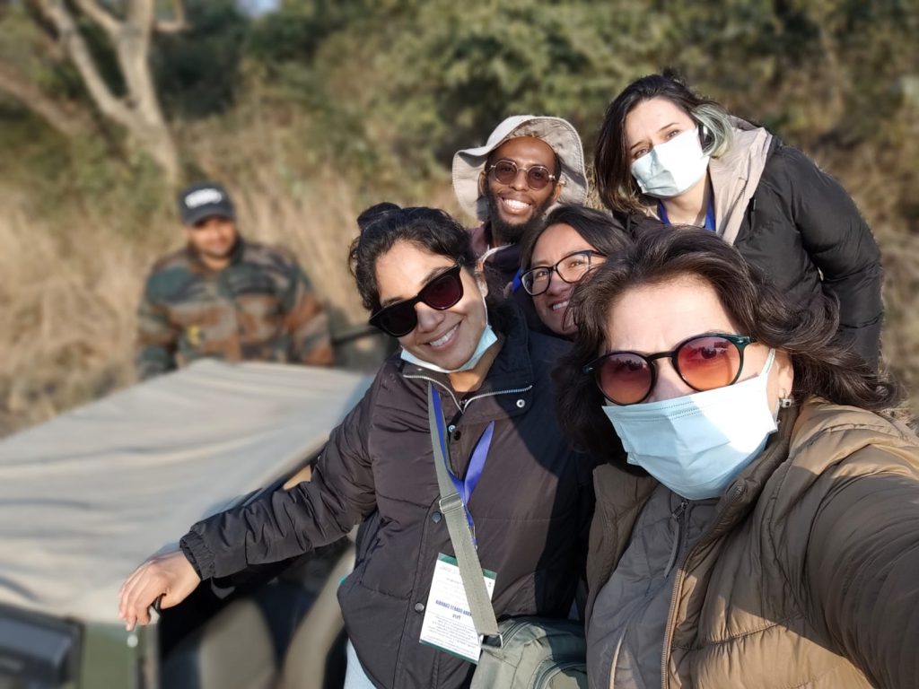
One of the highlights of the training was a field trip to the Rajaji Tiger Reserve in Haridwar. Here, participants engaged in satellite image interpretation exercises, honing their skills in detecting various land covers and collecting GPS points for integration into GIS environments. The reserve served as a living laboratory, showcasing firsthand the impact of urban expansion on ecosystems and the ongoing efforts to restore and conserve biodiversity. Participants gained invaluable insights from the experiences shared by local authorities, deepening their
understanding of real-world challenges and solutions. Additionally, the visit to an Eco-restoration site of Japan International Cooperation Agency (JICA) implemented by the Uttarakhand Forest Department, provided further context and inspiration. Witnessing firsthand the tangible results of restoration efforts underscored the importance of collective action and community engagement in combating land degradation.
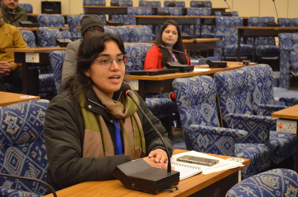
The training was attended by 18 participants from 16 countries, including the United Kingdom (1), Morocco (1), Algeria (1), Mauritania (2), Nigeria (1), Kenya( 1), Zambia (1), Madagascar (1), Turkey (1), Armenia (1), India (1), Nepal (1), Indonesia (1), Mexico (1) and Peru (1); representing a mosaic of perspectives, cultures, and experiences. While the language barrier posed initial challenges for some participants, we quickly overcame this through teamwork and mutual support. As the only participant from South America, this experience was a unique opportunity for me to engage with the workshop’s content, learn, and converse about research and restoration experiences with high-level experts. The friendships and experiences cultivated during the course, along with establishing networks and alliances with individuals from around the world and diverse cultures, were invaluable. Looking ahead, the continuity of this training is perhaps its greatest asset.
Currently, we are working on a team project that we will present during the year 2024. The group’s work consists of a comparative analysis of the degradation of the Sundarbans mangroves in India, one of the largest mangroves in the world, and Tumbes in Peru. Both are ecologically, socially and economically important protected areas and RAMSAR sites. However, they face threats from unsustainable human activities. We will compare the current state of degradation of both ecosystems and identify their main threats and stressors.
The international training on assessing the dynamics of land degradation and restoration efforts was an enriching experience and a knowledge platform that provided us with innovative strategies to address land degradation. Through disseminating this knowledge, we are now familiar with the necessary basic tools for identifying land degradation dynamics and applying remote sensing and GIS tools in different areas of our territory.